GEN 3.2 AERONAUTICAL CHARTS
GEN 3.2.1 RESPONSIBLE SERVICE
The aeronautical charts contained in the AIP are published by the AIS headquarters (see GEN 3.1.1) in accordance with the provisions contained in ICAO Annex 4 – Aeronautical Charts.
GEN 3.2.2 MAINTENANCE OF CHARTS
The aeronautical charts included in the AIP are kept up to date by amendments to the AIP. Corrections to aeronautical charts not contained in the AIP are promulgated by AIP Amendments and are listed under paragraph GEN 3.2.8 of this section. The information concerning the planning for or issuance of new maps and charts is notified by AIC.
Incorrect information detected on published charts is corrected by NOTAM if it is of operational significance.
GEN 3.2.3 PURCHASE ARRANGEMENTS
The Aeronautical Chart ICAO 1:500 000 of Latvia is the official aeronautical chart which is not contained in the AIP of Latvia.
The sale of the Aeronautical Chart of Latvia - ICAO 1:500 000 is delegated to LLC “Karšu veikals Jāņa sēta” and the chart may be obtained directly from LLC „Karšu veikals Jāņa sēta” or on the website www.karsuveikals.lv.
Post: LLC „Karšu veikals Jāņa sēta”
Elizabetes iela 85a,
Rīga, LV – 1050, Latvija
Phone: +371 27000062
Fax: +371 67828039
Email: veikals@karsuveikals.lv
URL: https://www.karsuveikals.lv
GEN 3.2.4 AERONAUTICAL CHARTS SERIES AVAILABLE
The following series of aeronautical charts are produced:
a. Aeronautical Chart - ICAO 1:500 000;
b. Aerodrome Chart – ICAO;
c. Aircraft Parking/Docking Chart - ICAO;
d. Aerodrome Ground Movement Chart - ICAO;
e. Aerodrome Obstacle Chart - ICAO - Type A (for each runway);
f. Aerodrome Terrain and Obstacle Chart — ICAO (Electronic);
g. En-route Chart - ICAO;
h. Standard Departure Chart - Instrument (SID) - ICAO;
i. Standard Arrival Chart - Instrument (STAR) - ICAO;
j. Instrument Approach Chart - ICAO (for each runway and procedure type);
k. Visual Approach Chart - ICAO;
l. ATC Surveillance Minimum Altitude Chart - ICAO;
m. Precision Approach Terrain Chart - ICAO.
The charts currently available are listed under paragraph GEN 3.2.5 of this section.
General description of each series:
a. Aeronautical Chart - ICAO 1:500 000. This series is constructed on Lambert Conformal Conic Projection. The aeronautical data shown are consistent with the use of short and medium range operations and depict all relevant features. The chart includes a selection of aerodromes, significant obstacles, elements of ATS system, prohibited, restricted and dangerous areas, and radio navigation aids. The chart provides the information needed for visual air navigation and is also used as a pre-flight planning chart.
b. Aerodrome Chart - ICAO. This chart contains detailed aerodrome data to provide flight crews with the information that will facilitate the ground movement of aircraft:
- from the aircraft stand to the runway; and
- from the runway to the aircraft stand.
It also provides essential operational information at the aerodrome.
c. Aircraft Parking/Docking Chart - ICAO. This chart is produced for those aerodromes where, due to the complexity of the terminal facilities, the information to facilitate the ground movement of aircraft between the taxiways and the aircraft stands and the parking/docking of aircraft cannot be shown with sufficient clarity on the Aerodrome/Heliport Chart — ICAO or on the Aerodrome Ground Movement Chart - ICAO.
d. Aerodrome Ground Movement Chart - ICAO. This chart is produced for those aerodromes where due to the complexity of the terminal facilities, the information to facilitate the ground movement of aircraft between the taxiways and the aircraft stands and the parking of aircraft cannot be shown with sufficient clarity on the Aerodrome Chart – ICAO.
This supplementary chart provides flight crews with the detailed information to facilitate the ground movement of aircraft between the taxiways and the aircraft stands and the parking of aircraft.
e. Aerodrome Obstacle Chart - ICAO - Type A (operating limitations). This chart contains detailed information on obstacles in the take-off flight path areas of aerodromes. It is shown in plan and profile view.
f. Aerodrome Terrain and Obstacle Chart — ICAO (Electronic). This electronic chart portrays the terrain and obstacle data in combination with aeronautical data, as appropriate, necessary to:
a) enable an operator to comply with the operating limitations of Annex 6, Part I, Chapter 5, and Part III, Section II, Chapter 3, by developing contingency procedures for use in the event of an emergency during a missed approach or take-off, and by performing aircraft operating limitations analysis; and
b) support the following air navigation applications:
1) instrument procedure design (including circling procedure);
2) aerodrome obstacle restriction and removal; and
3) provision of source data for the production of other aeronautical charts.
g. En-route Chart - ICAO. This chart is produced for the Riga FIR. The aeronautical data include all aerodromes, prohibited, restricted and danger areas and the air traffic services system in detail. The chart provides flight crews with information to facilitate navigation along ATS routes in compliance with air traffic services procedures.
h. Standard Departure Chart - Instrument (SID) - ICAO. This chart is produced whenever a standard departure route - instrument has been established and cannot be shown with sufficient clarity on the Area Chart - ICAO.
The aeronautical data include the aerodrome of departure, aerodrome(s) which affect the designated standard departure route - instrument, prohibited, restricted and danger areas and the air traffic services system.
This chart provides flight crews with information to enable them to comply with the designated standard departure route - instrument from the take-off phase to the en-route phase.
i. Standard Arrival Chart - Instrument (STAR) - ICAO. This chart is produced whenever a standard arrival route - instrument has been established and cannot be shown with sufficient clarity on the Area Chart -ICAO. The aeronautical data shown include the aerodrome of landing, aerodrome(s) which affect the designated standard arrival route - instrument, prohibited, restricted and danger areas and the air traffic services system. This chart provides flight crews with information to enable them to comply with the designated standard arrival route - instrument from the en-route phase to the approach phase.
j. Instrument Approach Chart - ICAO. This chart is produced for all aerodromes used by civil aviation where instrument approach procedures have been established. A separate Instrument Approach Chart –ICAO has been provided for each approach procedure. The aeronautical data shown include the information on aerodromes, prohibited, restricted and danger areas, radio communication facilities and navigation aids, minimum sector altitude, procedure track portrayed in plan and profile view, aerodrome operating minima, etc. This chart provides flight crews with information that will enable them to perform an approved instrument approach procedure to the runway of intended landing including the missed approach procedure and where applicable, associated holding patterns.
k. Visual Approach Chart - ICAO. This chart is produced for aerodromes used by civil aviation where:
- only limited navigation facilities are available; or
- radio communication facilities are not available; or
- no adequate aeronautical charts of the aerodrome and its surroundings at 1:500 000 or greater scale are available; or
- visual approach procedures have been established.
The aeronautical data shown include the information on aerodromes, obstacles, designated airspace, visual approach information, radio navigation aids and communication facilities as appropriate.
l. ATC Surveillance Minimum Altitude Chart - ICAO. This chart provides information that will enable flight crews to monitor and cross-check altitudes assigned by a controller using an ATS surveillance system.
m. Precision Approach Terrain Chart - ICAO. This chart provides detailed terrain profile information within a defined portion of the final approach so as to enable aircraft operating agencies to assess the effect of the terrain on decision height determination by the use of radio altimeters.
GEN 3.2.5 LIST OF AERONAUTICAL CHARTS AVAILABLE
| Type | Scale | AD/HLP Name | Chart Designator | Price | Effective date |
|---|---|---|---|---|---|
| ENROUTE CHART - ICAO (FL095 - FL660) | 1:1550000 | ENR_6_1_20210520 | 20 MAY 2021 | ||
| ENROUTE CHART - ICAO (FL095 - FL660) | 1:1550000 | ENR_6_1_20210617 | 17 JUN 2021 | ||
| LOWER AIRSPACE CHART (GND-FL095) — non-ICAO | 1:1550000 | ENR_6_2_20210520 | 20 MAY 2021 | ||
| LOWER AIRSPACE CHART (GND-FL095) — non-ICAO | 1:1550000 | ENR_6_2_20210617 | 17 JUN 2021 | ||
| PROHIBITED, RESTRICTED and DANGER AREAS - Index Chart — non-ICAO | 1:2500000 | ENR_6_3_20210520 | 20 MAY 2021 | ||
| PROHIBITED, RESTRICTED and DANGER AREAS - Index Chart — non-ICAO | 1:2500000 | ENR_6_3_20210617 | 17 JUN 2021 | ||
| MILITARY EXERCISE and TRAINING AREAS - Index Chart — non-ICAO | 1:2500000 | ENR_6_4_20210520 | 20 MAY 2021 | ||
| NEFAB FRA and DK/SE consolidated area — non-ICAO | 1:10000000 | ENR_6_5_20201105 | 05 NOV 2020 | ||
| NEFAB FRA - RIGA FIR RELEVANT POINTS — non-ICAO | 1:1650000 | ENR_6_6_20200910 | 10 SEP 2020 | ||
| NEFAB FRA - RIGA FIR RELEVANT POINTS — non-ICAO | 1:1650000 | ENR_6_6_20210617 | 17 JUN 2021 | ||
| Aerodrome chart — ICAO | 1:3000 | ADAZI | EVAD_2_24_1_20200521 | 21 MAY 2020 | |
| Aerodrome chart — ICAO | 1:4000 | CESIS | EVCA_2_24_1_20200521 | 21 MAY 2020 | |
| Aerodrome chart — ICAO | 1:5000 | IKSHKILE | EVPA_2_24_1_20200716 | 16 JUL 2020 | |
| Aerodrome chart — ICAO | 1:20000 | JURMALA AIRPORT | EVJA_2_24_1_20190523 | 23 MAY 2019 | |
| Aerodrome chart — ICAO | 1:20000 | LIELVARDE (MIL) | EVGA_2_24_1_20200716 | 16 JUL 2020 | |
| Aerodrome chart — ICAO | 1:20000 | LIELVARDE (MIL) | EVGA_2_24_1_20210617 | 17 JUN 2021 | |
| Aerodrome chart — ICAO | 1:20000 | LIEPAJA | EVLA_2_24_1_20210520 | 20 MAY 2021 | |
| Aerodrome chart — ICAO | 1:4000 | LIMBAZI | EVLI_2_24_1_20201105 | 05 NOV 2020 | |
| Aerodrome chart — ICAO | 1:25000 | RIGA | EVRA_2_24_1_20210520 | 20 MAY 2021 | |
| Aerodrome chart — ICAO | 1:8000 | SPILVE | EVRS_2_24_1_20180329 | 29 MAR 2018 | |
| Aerodrome chart — ICAO | 1:15000 | VENTSPILS | EVVA_2_24_1_20210520 | 20 MAY 2021 | |
| Aircraft Parking/Docking Chart — ICAO | 1:15000 | RIGA | EVRA_2_24_2_20210520 | 20 MAY 2021 | |
| Aerodrome Ground Movement Chart — ICAO | 1:2500 | LIEPAJA | EVLA_2_24_3_20210520 | 20 MAY 2021 | |
| Aerodrome Ground Movement Chart — ICAO | 1:8000 | RIGA | EVRA_2_24_3_20210520 | 20 MAY 2021 | |
| Aerodrome Obstacle Chart — ICAO Type A (for each runway) | 1:15000 | LIEPAJA | EVLA_2_24_4_RWY06_24_20170330 | 30 MAR 2017 | |
| Aerodrome Obstacle Chart — ICAO Type A (for each runway) | 1:15000 | RIGA | EVRA_2_24_4_RWY18_36_20201203 | 03 DEC 2020 | |
| Precision Approach Terrain Chart — ICAO | 1:2500 | RIGA | EVRA_2_24_7_20200910 | 10 SEP 2020 | |
| Standard Departure Chart — Instrument (SID) — ICAO | 1:500000 | LIEPAJA | EVLA_2_24_9_RWY06_20210520 | 20 MAY 2021 | |
| Standard Departure Chart — Instrument (SID) — ICAO | 1:500000 | LIEPAJA | EVLA_2_24_9_RWY24_20210520 | 20 MAY 2021 | |
| Standard Departure Chart — Instrument (SID) — ICAO | 1:750000 | RIGA | EVRA_2_24_9_RWY18WB_20200910 | 10 SEP 2020 | |
| Standard Departure Chart — Instrument (SID) — ICAO | 1:750000 | RIGA | EVRA_2_24_9_RWY18WB_20210617 | 17 JUN 2021 | |
| Standard Departure Chart — Instrument (SID) — ICAO | 1:750000 | RIGA | EVRA_2_24_9_RWY18EB_20210128 | 28 JAN 2021 | |
| Standard Departure Chart — Instrument (SID) — ICAO | 1:750000 | RIGA | EVRA_2_24_9_RWY18EB_20210617 | 17 JUN 2021 | |
| Standard Departure Chart — Instrument (SID) — ICAO | 1:750000 | RIGA | EVRA_2_24_9_RWY36WB_20200910 | 10 SEP 2020 | |
| Standard Departure Chart — Instrument (SID) — ICAO | 1:750000 | RIGA | EVRA_2_24_9_RWY36WB_20210617 | 17 JUN 2021 | |
| Standard Departure Chart — Instrument (SID) — ICAO | 1:750000 | RIGA | EVRA_2_24_9_RWY36EB_20210128 | 28 JAN 2021 | |
| Standard Departure Chart — Instrument (SID) — ICAO | 1:750000 | RIGA | EVRA_2_24_9_RWY36EB_20210617 | 17 JUN 2021 | |
| Standard Arrival Chart — Instrument (STAR) — ICAO | 1:750000 | RIGA | EVRA_2_24_11_RWY18WB_20210128 | 28 JAN 2021 | |
| Standard Arrival Chart — Instrument (STAR) — ICAO | 1:750000 | RIGA | EVRA_2_24_11_RWY18WB_20210617 | 17 JUN 2021 | |
| Standard Arrival Chart — Instrument (STAR) — ICAO | 1:750000 | RIGA | EVRA_2_24_11_RWY18EB_20210128 | 28 JAN 2021 | |
| Standard Arrival Chart — Instrument (STAR) — ICAO | 1:750000 | RIGA | EVRA_2_24_11_RWY18EB_20210617 | 17 JUN 2021 | |
| Standard Arrival Chart — Instrument (STAR) — ICAO | 1:750000 | RIGA | EVRA_2_24_11_RWY36WB_20210128 | 28 JAN 2021 | |
| Standard Arrival Chart — Instrument (STAR) — ICAO | 1:750000 | RIGA | EVRA_2_24_11_RWY36WB_20210617 | 17 JUN 2021 | |
| Standard Arrival Chart — Instrument (STAR) — ICAO | 1:750000 | RIGA | EVRA_2_24_11_RWY36EB_20210128 | 28 JAN 2021 | |
| Standard Arrival Chart — Instrument (STAR) — ICAO | 1:750000 | RIGA | EVRA_2_24_11_RWY36EB_20210617 | 17 JUN 2021 | |
| ATC Surveillance Minimum Altitude Chart — ICAO | 1:500000 | RIGA | EVRA_2_24_12_20200910 | 10 SEP 2020 | |
| ATC Surveillance Minimum Altitude Chart — ICAO | 1:500000 | RIGA | EVRA_2_24_12_20210617 | 17 JUN 2021 | |
| Instrument Approach Chart — ICAO | 1:400000 | LIEPAJA | EVLA_2_24_13_RWY24_ILS_Y_20210520 | 20 MAY 2021 | |
| Instrument Approach Chart — ICAO | 1:400000 | LIEPAJA | EVLA_2_24_13_RWY24_ILS_Z_20210520 | 20 MAY 2021 | |
| Instrument Approach Chart — ICAO | 1:400000 | LIEPAJA | EVLA_2_24_13_RWY24_LOC_20210520 | 20 MAY 2021 | |
| Instrument Approach Chart — ICAO | 1:400000 | LIEPAJA | EVLA_2_24_13_RWY06_VOR_Y_20210520 | 20 MAY 2021 | |
| Instrument Approach Chart — ICAO | 1:400000 | LIEPAJA | EVLA_2_24_13_RWY06_VOR_Z_20210520 | 20 MAY 2021 | |
| Instrument Approach Chart — ICAO | 1:400000 | LIEPAJA | EVLA_2_24_13_RWY24_VOR_Y_20210520 | 20 MAY 2021 | |
| Instrument Approach Chart — ICAO | 1:400000 | LIEPAJA | EVLA_2_24_13_RWY24_VOR_Z_20210520 | 20 MAY 2021 | |
| Instrument Approach Chart — ICAO | 1:500000 | RIGA | EVRA_2_24_13_RWY18_ILS_20210128 | 28 JAN 2021 | |
| Instrument Approach Chart — ICAO | 1:500000 | RIGA | EVRA_2_24_13_RWY18_ILS_20210617 | 17 JUN 2021 | |
| Instrument Approach Chart — ICAO | 1:500000 | RIGA | EVRA_2_24_13_RWY36_ILS_20210128 | 28 JAN 2021 | |
| Instrument Approach Chart — ICAO | 1:500000 | RIGA | EVRA_2_24_13_RWY36_ILS_20210617 | 17 JUN 2021 | |
| Instrument Approach Chart — ICAO | 1:500000 | RIGA | EVRA_2_24_13_RWY18_LOC_20210128 | 28 JAN 2021 | |
| Instrument Approach Chart — ICAO | 1:500000 | RIGA | EVRA_2_24_13_RWY18_LOC_20210617 | 17 JUN 2021 | |
| Instrument Approach Chart — ICAO | 1:500000 | RIGA | EVRA_2_24_13_RWY36_LOC_20210128 | 28 JAN 2021 | |
| Instrument Approach Chart — ICAO | 1:500000 | RIGA | EVRA_2_24_13_RWY36_LOC_20210617 | 17 JUN 2021 | |
| Instrument Approach Chart — ICAO | 1:500000 | RIGA | EVRA_2_24_13_RWY18_VOR_20210128 | 28 JAN 2021 | |
| Instrument Approach Chart — ICAO | 1:500000 | RIGA | EVRA_2_24_13_RWY18_VOR_20210617 | 17 JUN 2021 | |
| Instrument Approach Chart — ICAO | 1:500000 | RIGA | EVRA_2_24_13_RWY36_VOR_20210128 | 28 JAN 2021 | |
| Instrument Approach Chart — ICAO | 1:500000 | RIGA | EVRA_2_24_13_RWY36_VOR_20210617 | 17 JUN 2021 | |
| Visual Approach Chart — ICAO | 1:250000 | ADAZI | EVAD_2_24_14_20210520 | 20 MAY 2021 | |
| Visual Approach Chart — ICAO | 1:250000 | ADAZI | EVAD_2_24_14_20210617 | 17 JUN 2021 | |
| Visual Approach Chart — ICAO | 1:250000 | CESIS | EVCA_2_24_14_20210520 | 20 MAY 2021 | |
| Visual Approach Chart — ICAO | 1:250000 | CESIS | EVCA_2_24_14_20210617 | 17 JUN 2021 | |
| Visual Approach Chart — ICAO | 1:250000 | IKSHKILE | EVPA_2_24_14_20201105 | 05 NOV 2020 | |
| Visual Approach Chart — ICAO | 1:250000 | IKSHKILE | EVPA_2_24_14_20210617 | 17 JUN 2021 | |
| Visual Approach Chart — ICAO | 1:350000 | JURMALA AIRPORT | EVJA_2_24_14_20210520 | 20 MAY 2021 | |
| Visual Approach Chart — ICAO | 1:350000 | JURMALA AIRPORT | EVJA_2_24_14_20210617 | 17 JUN 2021 | |
| Visual Approach Chart — ICAO | 1:250000 | LIELVARDE (MIL) | EVGA_2_24_14_20201105 | 05 NOV 2020 | |
| Visual Approach Chart — ICAO | 1:270000 | LIELVARDE (MIL) | EVGA_2_24_14_20210617 | 17 JUN 2021 | |
| Visual Approach Chart — ICAO | 1:300000 | LIEPAJA | EVLA_2_24_14_20210520 | 20 MAY 2021 | |
| Visual Approach Chart — ICAO | 1:250000 | LIMBAZI | EVLI_2_24_14_20200910 | 10 SEP 2020 | |
| Visual Approach Chart — ICAO | 1:250000 | LIMBAZI | EVLI_2_24_14_20210617 | 17 JUN 2021 | |
| Visual Approach Chart — ICAO | 1:250000 | RIGA | EVRA_2_24_14_20210520 | 20 MAY 2021 | |
| Visual Approach Chart — ICAO | 1:250000 | RIGA | EVRA_2_24_14_20210617 | 17 JUN 2021 | |
| Visual Approach Chart — ICAO | 1:250000 | SPILVE | EVRS_2_24_14_20210520 | 20 MAY 2021 | |
| Visual Approach Chart — ICAO | 1:250000 | SPILVE | EVRS_2_24_14_20210617 | 17 JUN 2021 | |
| Visual Approach Chart — ICAO | 1:250000 | VENTSPILS | EVVA_2_24_14_20210520 | 20 MAY 2021 | |
| Instrument Approach Chart for Training Flights — non-ICAO | 1:400000 | RIGA | EVRA_2_24_16_RWY18_ILS_CATA_20210128 | 28 JAN 2021 | |
| Instrument Approach Chart for Training Flights — non-ICAO | 1:400000 | RIGA | EVRA_2_24_16_RWY18_ILS_CATA_20210617 | 17 JUN 2021 | |
| Instrument Approach Chart for Training Flights — non-ICAO | 1:400000 | RIGA | EVRA_2_24_16_RWY18_ILS_CATBC_20210128 | 28 JAN 2021 | |
| Instrument Approach Chart for Training Flights — non-ICAO | 1:400000 | RIGA | EVRA_2_24_16_RWY18_ILS_CATBC_20210617 | 17 JUN 2021 | |
| Instrument Approach Chart for Training Flights — non-ICAO | 1:400000 | RIGA | EVRA_2_24_16_RWY36_ILS_CATA_20210128 | 28 JAN 2021 | |
| Instrument Approach Chart for Training Flights — non-ICAO | 1:400000 | RIGA | EVRA_2_24_16_RWY36_ILS_CATA_20210617 | 17 JUN 2021 | |
| Instrument Approach Chart for Training Flights — non-ICAO | 1:400000 | RIGA | EVRA_2_24_16_RWY36_ILS_CATBC_20210128 | 28 JAN 2021 | |
| Instrument Approach Chart for Training Flights — non-ICAO | 1:400000 | RIGA | EVRA_2_24_16_RWY36_ILS_CATBC_20210617 | 17 JUN 2021 | |
| Arrival and Departure Route Chart — non-ICAO | 1:100000 | SPILVE | EVRS_2_24_17_20210520 | 20 MAY 2021 | |
| Arrival and Departure Route Chart — non-ICAO | 1:100000 | SPILVE | EVRS_2_24_17_20210617 | 17 JUN 2021 | |
| Heliport Chart — ICAO | 1:1500 | LIELVARDE M SOLA | EVSM_3_23_1_20200910 | 10 SEP 2020 | |
| Heliport Chart — ICAO | 1:1500 | LUDZA AVP | EVLU_3_23_1_20200910 | 10 SEP 2020 | |
| Visual Approach Chart — ICAO | 1:250000 | LIELVARDE M SOLA | EVSM_3_23_8_20201105 | 05 NOV 2020 | |
| Heliport Chart — ICAO | 1:1000 | NAKOTNE HELIPORT | EVHN_3_23_1_20210617 | 17 JUN 2021 | |
| Visual Approach Chart — ICAO | 1:250000 | LIELVARDE M SOLA | EVSM_3_23_8_20210617 | 17 JUN 2021 | |
| Visual Approach Chart — ICAO | 1:250000 | LUDZA AVP | EVLU_3_23_8_20200910 | 10 SEP 2020 | |
| Aeronautical Chart-ICAO (ANC) - Digital version | 1:500000 | VFR_DIGITAL_20210520 | 20 MAY 2021 | ||
| Visual Approach Chart — ICAO | 1:250000 | NAKOTNE HELIPORT | EVHN_3_23_8_20210617 | 17 JUN 2021 | |
| Aeronautical Chart-ICAO (ANC) - Paper version | 1:500000 | VFR_PAPER_20200521 | 21 MAY 2020 | ||
| Aeronautical Chart-ICAO (ANC) - Digital version | 1:500000 | VFR_DIGITAL_20210617 | 17 JUN 2021 | ||
| Aeronautical Chart-ICAO (ANC) - Paper version | 1:500000 | VFR_PAPER_20210617 | 17 JUN 2021 |
Aerodrome Terrain and Obstacle Charts — ICAO (Electronic) are available for the EVGA, EVLA, EVRA, EVVA aerodromes: https://ais.lgs.lv/page/eATOC
Aeronautical Chart-ICAO (ANC) - Digital version available at: https://ais.lgs.lv/page/VFR_Support
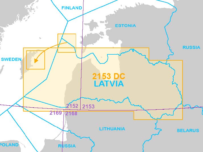
GEN 3.2.6 AERONAUTICAL CHART ICAO 1:500 000
GEN 3.2.7 TOPOGRAPHICAL CHARTS
To supplement the aeronautical charts, a wide range of topographical charts is available from:
Post:
State agency “Latvian Geospatial Information Agency”
Ojāra Vācieša iela 43
Rīga, LV-1004
Latvija
Tel:+371 25691504
Fax:+371 29370505
Email: pakalpojumi@lgia.gov.lv
AFS: NIL
GEN 3.2.8 CORRECTIONS TO CHARTS NOT CONTAINED IN THE AIP
|
Charts |
Location |
Corrections |
|---|---|---|
|
Aeronautical chart of Latvia – ICAO 1: 500 000 |
|
10th edition WEF 21 MAY 2020. The publication of this issue invalidates the previous issue. |
|
Aeronautical chart of Latvia – ICAO 1: 500 000 |
|
11th edition WEF 17 JUN 2021. The publication of this issue invalidates the previous issue. |
|
Aeronautical chart of Latvia – ICAO 1: 500 000 |
571134N 0243934E |
TSA9 lateral limits updated |
|
Aeronautical chart of Latvia – ICAO 1: 500 000 |
564603N 0244942E |
Obstacle LIELVARDE withdrawn. |
|
Aeronautical chart of Latvia – ICAO 1: 500 000 |
563745N 0210245E |
EVR3, EVR4 withdrawn. |
|
Aeronautical chart of Latvia – ICAO 1: 500 000 |
564624N 0244907E |
TRA7 LIELVARDE vertical limits updated. |
|
Aeronautical chart of Latvia – ICAO 1: 500 000 |
562809N 0215021E |
EVP2 VAINODE established. |
|
Aeronautical chart of Latvia – ICAO 1: 500 000 |
572512N 0265013E |
EVP3 LACUSILS established. |
|
Aeronautical chart of Latvia – ICAO 1: 500 000 |
573116N 0252438E |
EVP4 KAUGURMUIZA established. |
|
Aeronautical chart of Latvia – ICAO 1: 500 000 |
565705N 0240619E |
EVR2 vertical limits updated. |
|
Aeronautical chart of Latvia – ICAO 1: 500 000 |
565950N 0240706E |
SPILVE TMZ, CTAF added. |
|
Aeronautical chart of Latvia – ICAO 1: 500 000 |
563628N 0232730E |
NAKOTNE HELIPORT (EVHN) established. |
|
Aeronautical chart of Latvia – ICAO 1: 500 000 |
563623N 0232708E |
NAKOTNE CENTRA JAUNZEMJI (EVJC) withdrawn. |
|
Aeronautical chart of Latvia – ICAO 1: 500 000 |
565724N 0240545E |
OLD CITY HELIPORT (EVOC) withdrawn. |
|
Aeronautical chart of Latvia – ICAO 1: 500 000 |
561612N 0205533E |
EVR3 JURMALCIEMS1 and EVR4 JURMALCIEMS2 established. |
|
Aeronautical chart of Latvia – ICAO 1: 500 000 |
561612N 0205533E |
TRA18 JURMALCIEMS1 and TRA19 JURMALCIEMS2 established. |
|
Aeronautical chart of Latvia – ICAO 1: 500 000 |
563017N 0235542E |
Enroute DME Jaunsvirlauka (JVL) established. |
|
Aeronautical chart of Latvia – ICAO 1: 500 000 |
571839N 0250915E |
Enroute DME Raiskums (RSK) established. |
|
Aeronautical chart of Latvia – ICAO 1: 500 000 |
563821N 0215334E |
Enroute DME Rudbarzhi (RDB) established. |